

NGH's offline maps come in three styles. You also choose how much detail the map shows: which points of interest, which overlays, and from which zoom level small roads, tracks and paths appear. You find all of this in the map's menu. This article describes NGH 2.0.
To open the menu, go to the MAP section and tap the arrow at the left edge of the map. The map settings are under MAP and PREFERENCES.
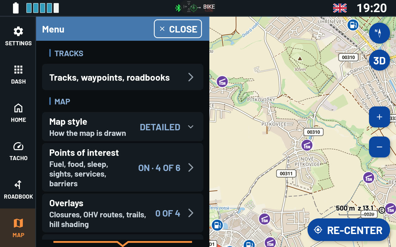
Map style
Tap Map style and choose one of three looks:
- Detailed - a topographic map with lots of detail: paths, huts, viewpoints, hill shading and contour lines.
- Road - the same place with less detail and no contour lines, so the roads stand out. Tracks and paths are off at first. You can switch them on under Roads and paths. For riders who stay on tarmac.
- Simple - a calm map you can read at a glance. It has soft colours and no overlays. Of the points of interest, it shows only Fuel and repair, Food and drink and Sights at first. Tracks are pale, and paths are off.
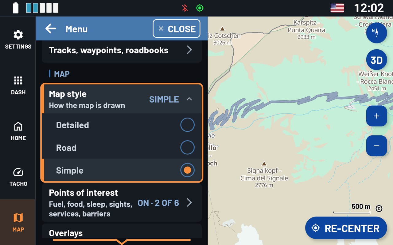
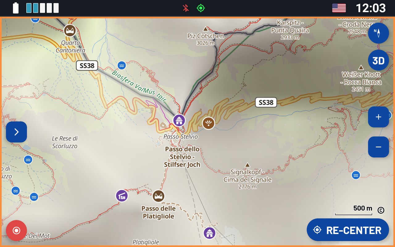
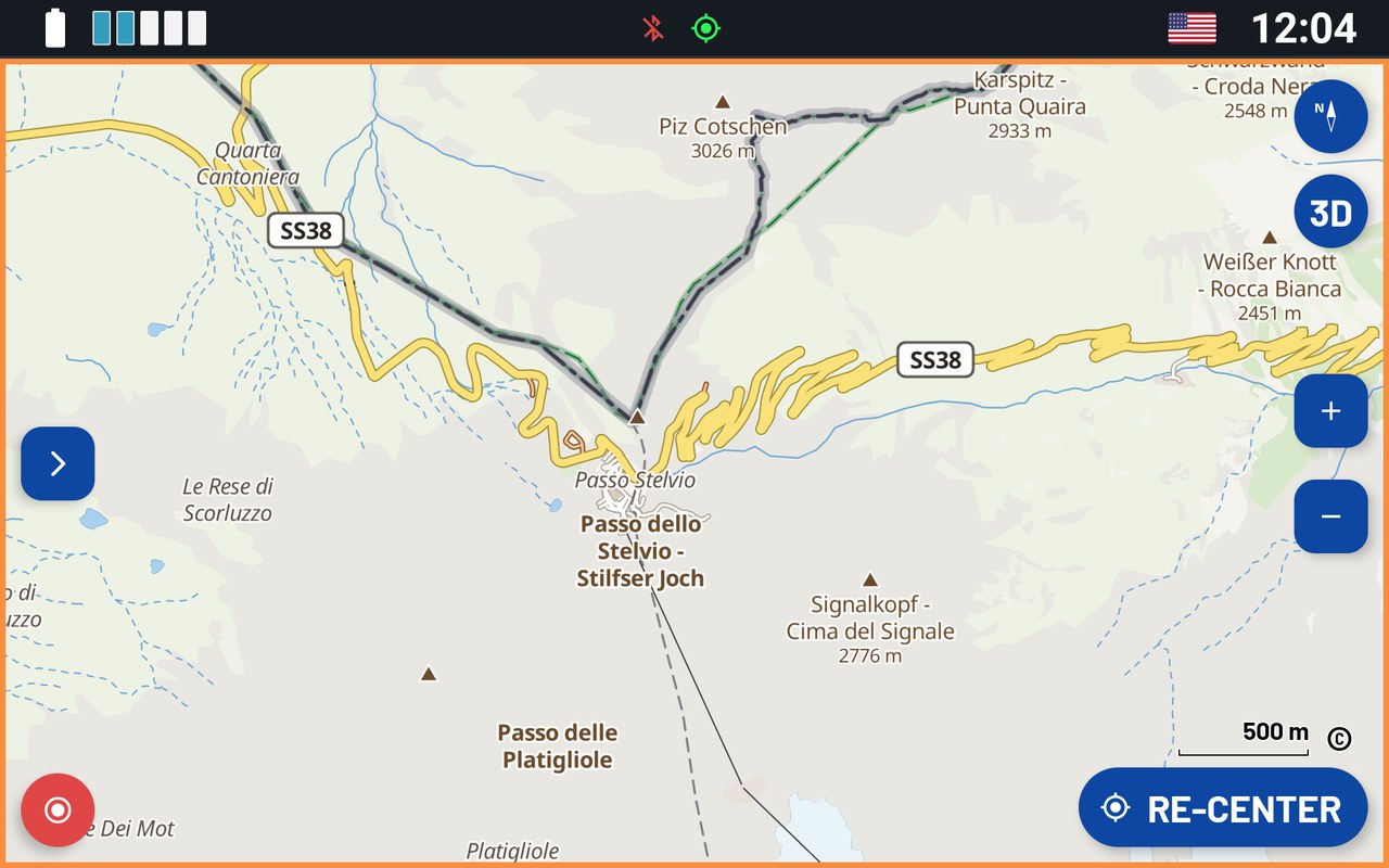
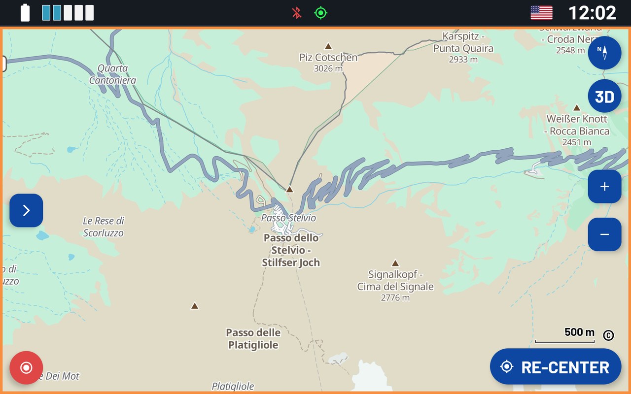
Note: Each map style keeps its own settings for Points of interest, Overlays and Roads and paths. So you can set up each style the way you like it. When you switch styles, each one keeps its settings. Choose the style first, then change its settings.
Points of interest
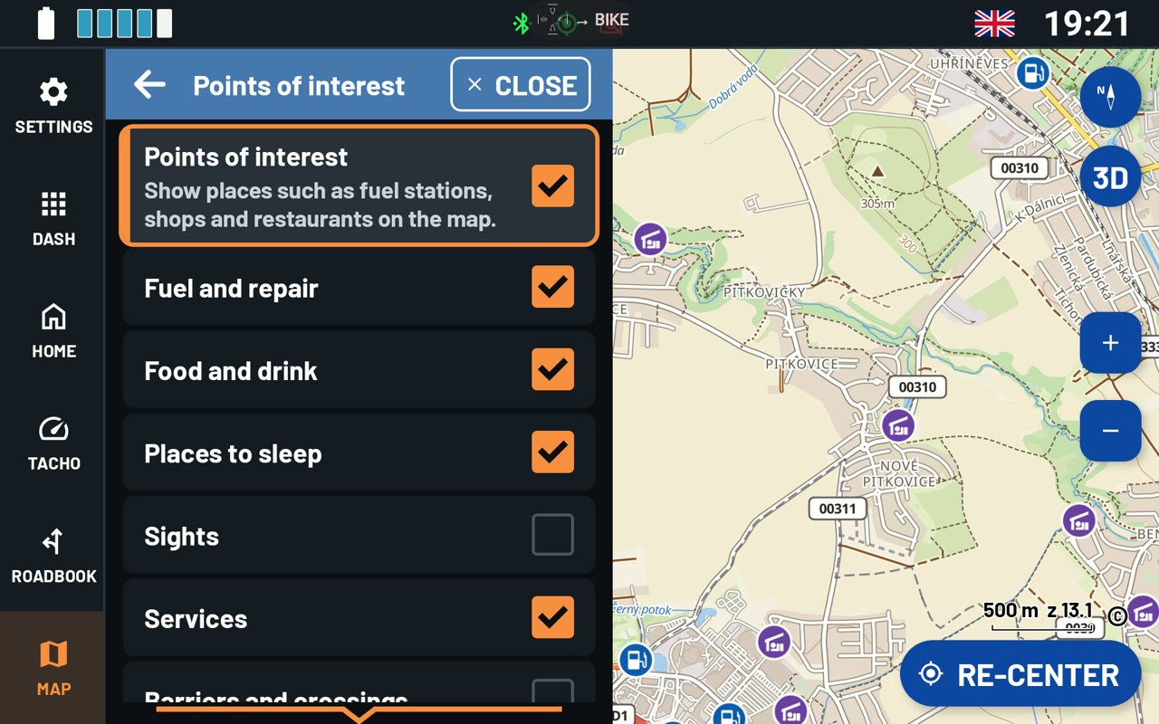
Under Points of interest you choose which points the map shows, for the style in use. Switch them all on or off at once, or each group on its own: Fuel and repair, Food and drink, Places to sleep, Sights, Services, and Barriers and crossings, such as fords and gates. Tap a point on the map to see its name and details.
Overlays
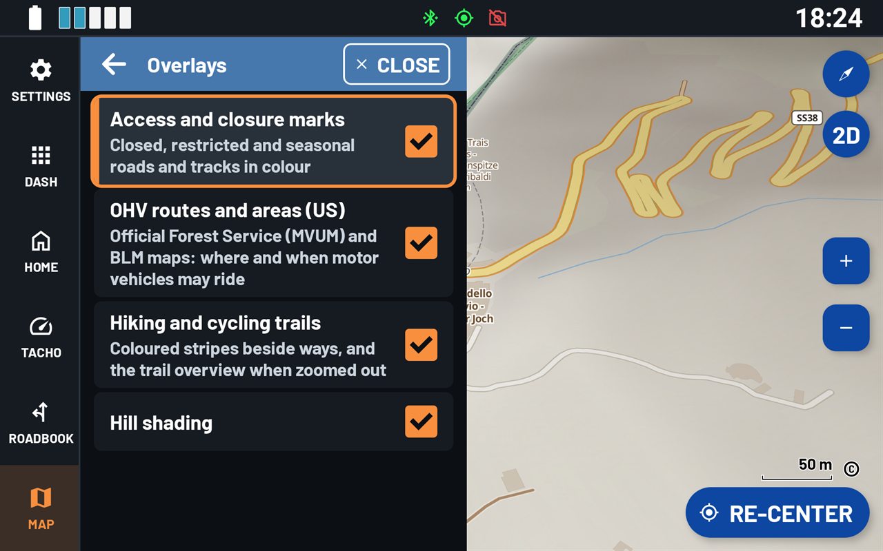
Overlays are drawn on top of the map style. Switch each one on or off for the style in use:
- Access and closure marks - closed, restricted and seasonal roads and tracks, shown in colour.
- OHV routes and areas (US) - the official maps of the Forest Service (MVUM) and the BLM. They show where and when motor vehicles may ride.
- Hiking and cycling trails - coloured stripes along marked trails. When you zoom out, an overview of the trails.
- Hill shading - the shape of the land.
Note: Hiking and cycling trails, hill shading and contour lines need the map's extras (see Offline maps below). If a map has no extras, nothing is drawn for it, even when the switch is on.
Roads and paths: when detail appears
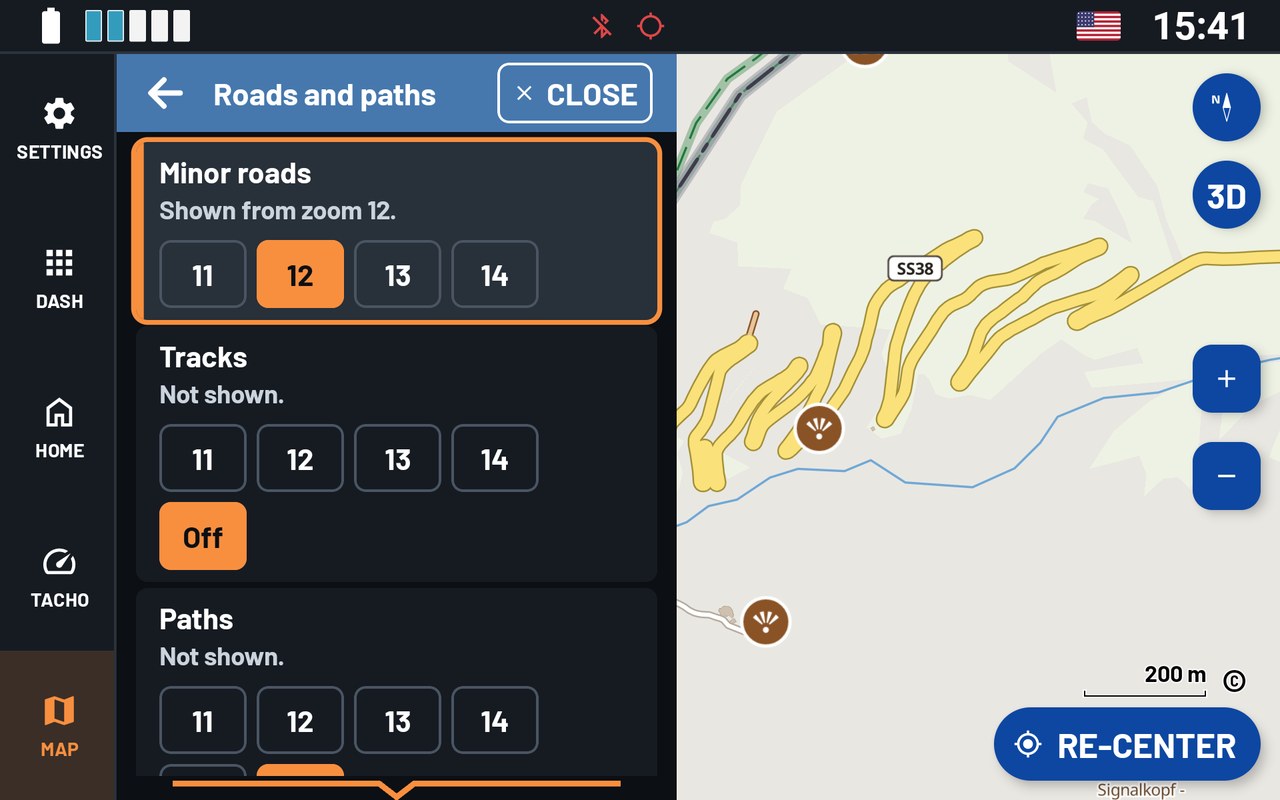
Here you choose from which zoom level the map shows Minor roads, Tracks and Paths. Each style has its own setting. You find it under Menu › PREFERENCES › Additional settings › Roads and paths.
A lower number shows them when you are zoomed further out. This helps off-road: most navigation apps show tracks only when you zoom in a lot. A higher number keeps the map clean when you zoom out. You can also switch Tracks and Paths Off.
Offline maps
Once the maps are on the device, they work without a connection. Go to Menu › Offline Maps:
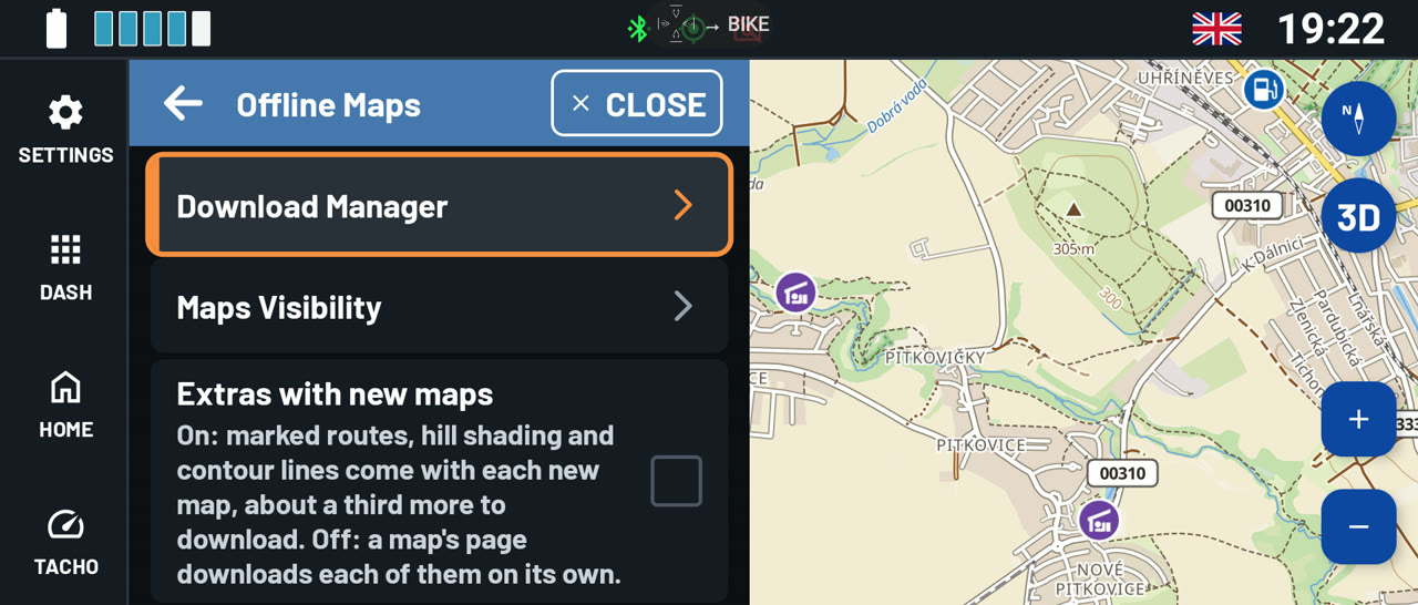
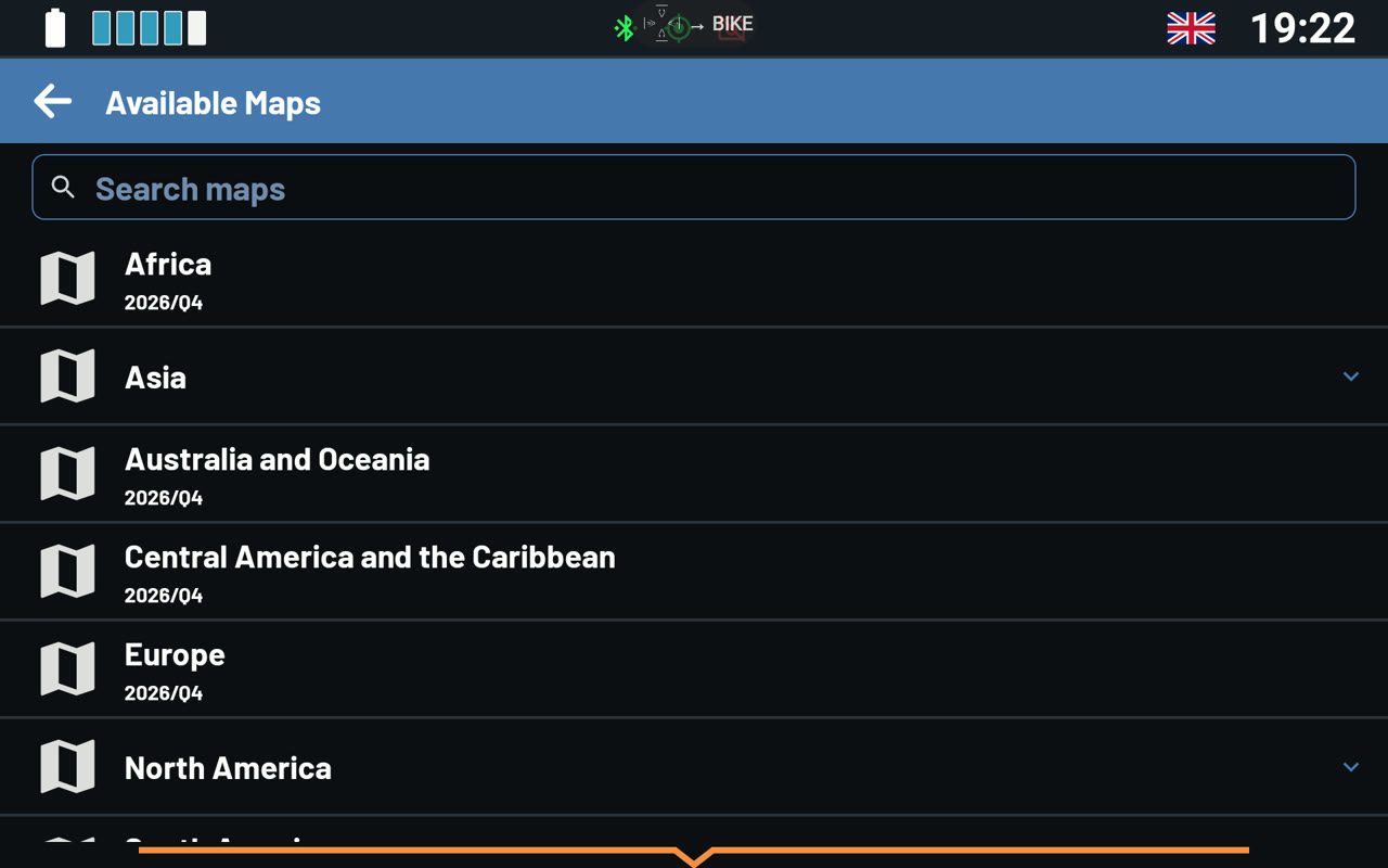
- Download Manager - the maps by continent and region, with a search. Tap a map to open its page.
- Maps Visibility - show or hide the maps on the device. Up to 20 maps are shown at a time.
- Extras with new maps - when this is on, every new map comes with its extras: marked routes, hill shading and contour lines. That is about a third more to download. When it is off, you can download each extra later, on the map's page.
A map's page shows its size, version and area. Download map gets the base map and its points of interest. Under EXTRAS, you can download Marked routes, Hill shading and Contour lines one by one. When a newer version is out, the page offers Update. Delete map frees the space.
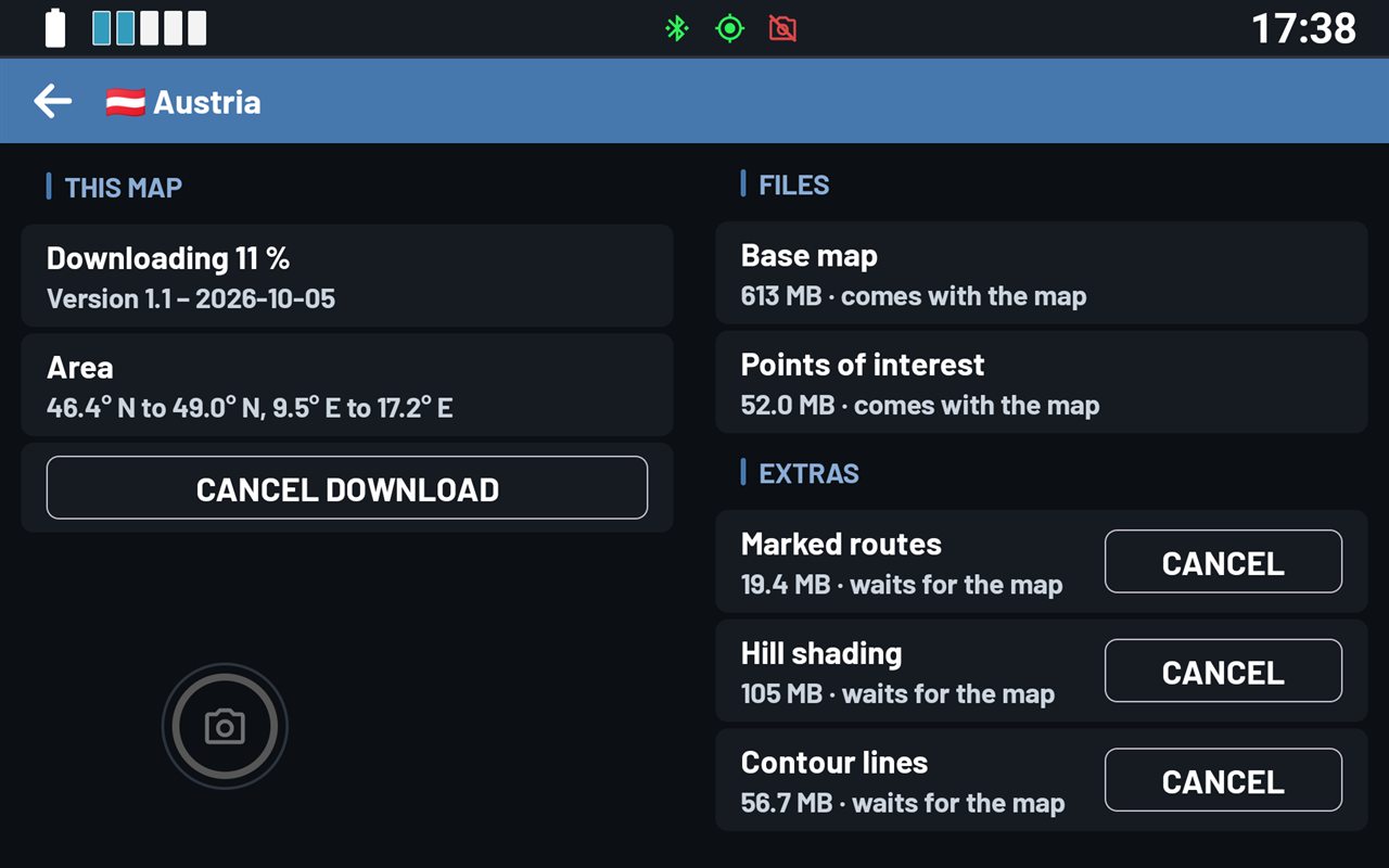
Tip: Riding only on roads? Skip the extras. Each map stays about a third smaller.
Was this article helpful?
That’s Great!
Thank you for your feedback
Sorry! We couldn't be helpful
Thank you for your feedback
Feedback sent
We appreciate your effort and will try to fix the article