

NGH keeps your GPX tracks, waypoints and roadbooks in one library. You can sort them into folders and choose which ones the map shows. You can follow one track as your active track. And you can give each track its own line style. This article describes NGH 2.0 on the Caretta, the CI Pad and Android phones.
Opening the library
- In the MAP section, tap the arrow at the left edge of the map. The Menu opens.
- Under TRACKS, tap Tracks, waypoints, roadbooks.
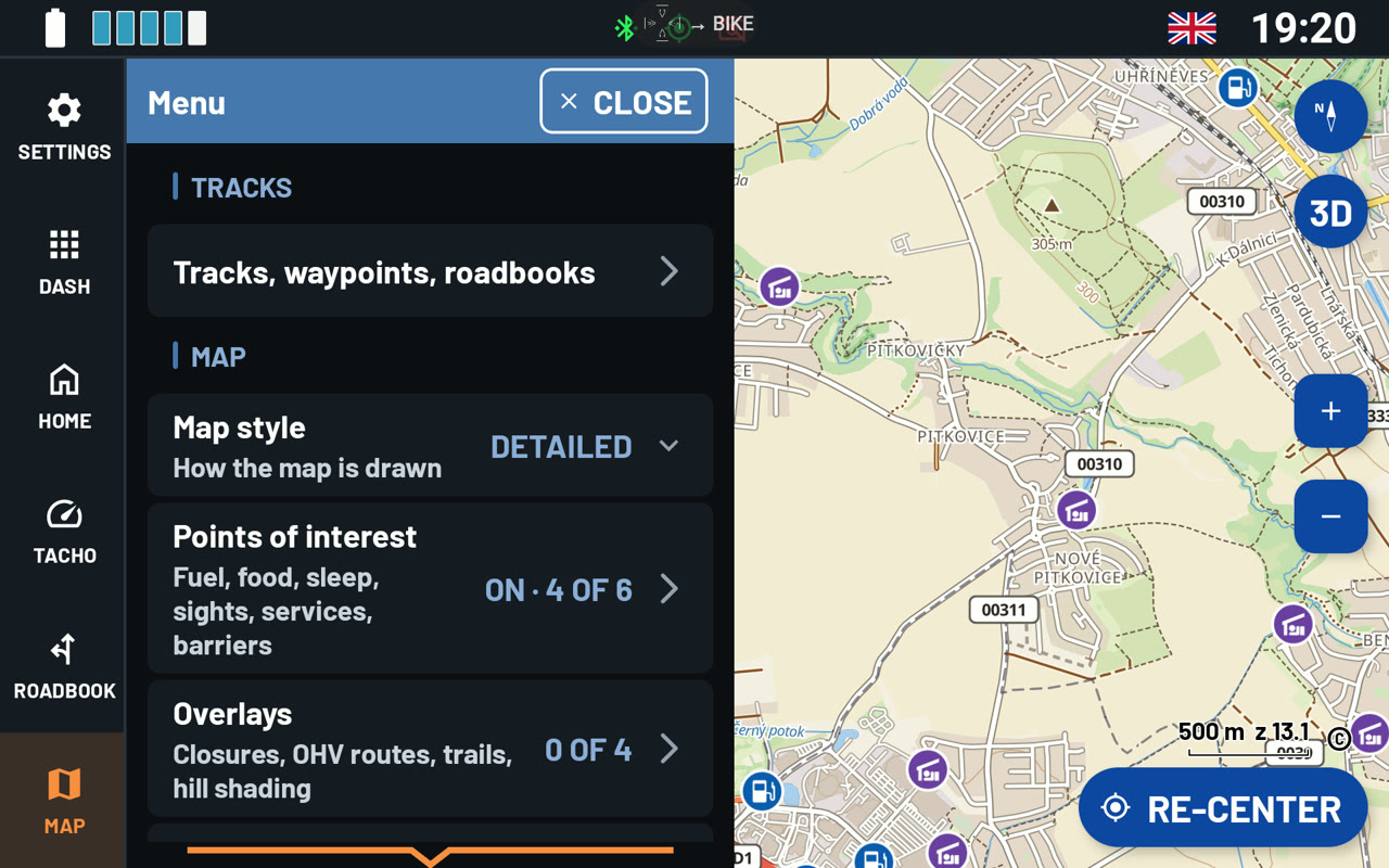
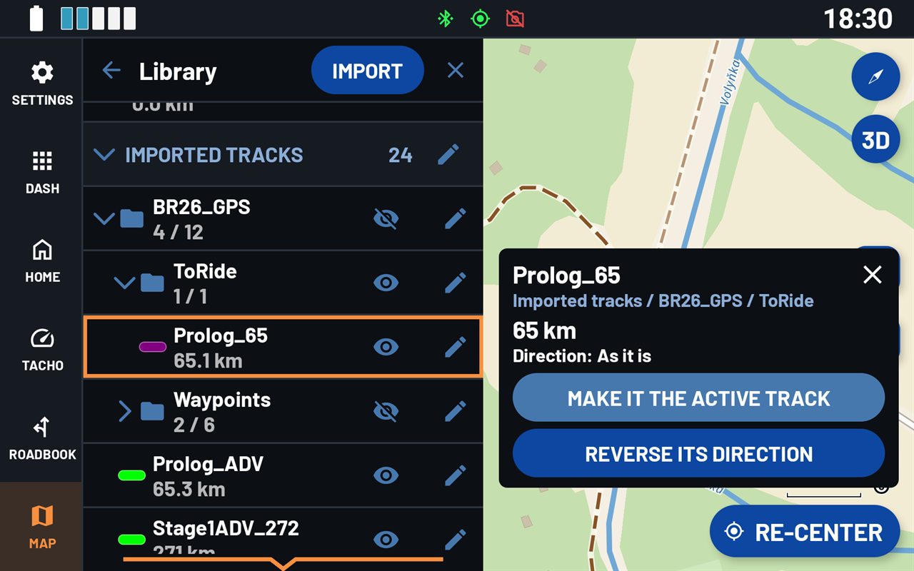
The library has four groups: Recorded tracks (your own rides), Imported tracks, Waypoints and Roadbooks. Each folder shows how many of its items are on the map. For example, 4 / 12 means that 4 of 12 are shown.
Importing a GPX file
- In the library, tap IMPORT.
- Pick the GPX file. It can be on the device, on an SD card or in a cloud drive. NGH reads files up to 50 MB.
NGH shows the new track on the map straight away. If a file holds several tracks, NGH puts them in a folder named after the file. If the file is already in the library, NGH asks before it imports it again. Tracks from Garmin GPX files keep their colours. Other tracks start grey.
Showing, hiding and organising
- Tap the eye next to a track to show it on the map or hide it. The eye next to a folder shows or hides everything in it.
- Tap a track's name to see its length and folder. From there you can make it the active track or reverse its direction.
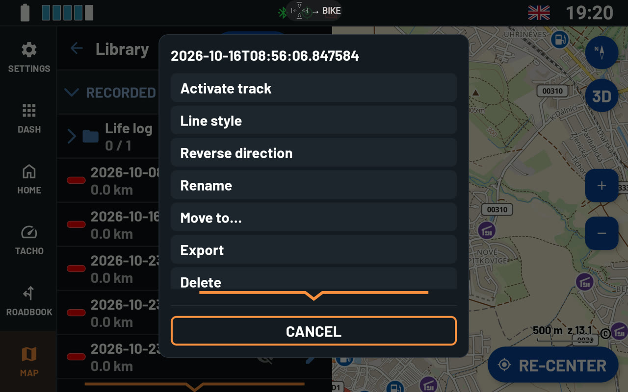
- Tap the pencil next to a track for more: Activate track, Line style, Reverse direction, Rename, Move to..., Export and Delete.
- The pencil next to a folder offers Show all / Hide all, New folder, Rename, Move to..., Export and Delete. New folder makes a folder inside this one. When you delete a folder, NGH asks whether to delete its items too or keep them.
- Export saves a track as a GPX file. For a folder, it saves all its tracks in one file. NGH also saves the line styles and folders in the file. So the tracks look the same when you import them into NGH on another device.
The active track
One track at a time can be your active track. To choose it, tap Activate track in the track's menu, or MAKE IT THE ACTIVE TRACK in its details. NGH then shows at the bottom of the map:
- LENGTH - how long the track is,
- TO END - how far it is to the end,
- TO TRACK - how far away the track is, when you are off it.
Reverse direction turns the track around, so you can ride it the other way. The arrows on the line turn too. In the library, the track is marked reversed.
To switch the panel off, go to Menu › PREFERENCES › Additional settings › Active track panel.
Line style
Every track can have its own look. Tap the pencil next to the track, then Line style. The map shows each change at once.
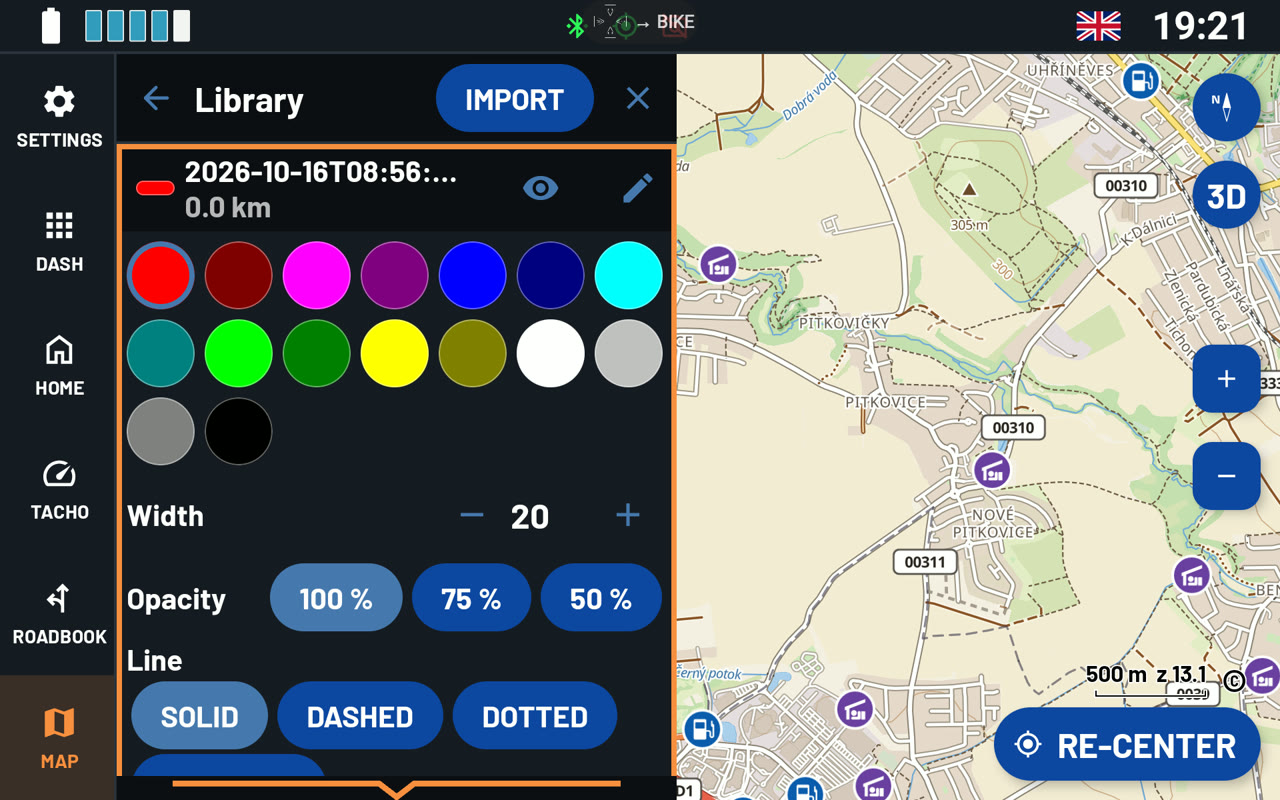
- Colour - one of 16 colours.
- Width - tap - or + to make the line thinner or thicker.
- Opacity - 100 %, 75 % or 50 %. Below 100 %, the map shows through the line.
- Line - SOLID, DASHED, DOTTED or DASH-DOT.
- Outline - a border in a second colour, with its own Outline width. It helps a track stand out on a busy map.
- Arrows - Small arrows sit close together inside the line. A Large arrow appears now and then. Arrow size % makes them bigger or smaller.
- Direction - As it is or Reversed.
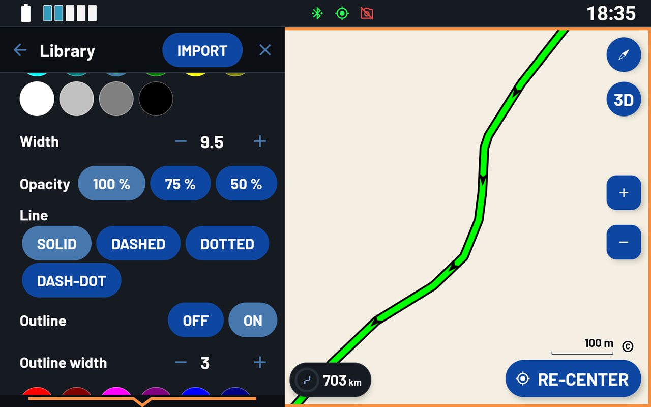
Tip: Give the track you follow a bright colour and an outline. Give the other tracks a thinner line at 50 %. Then the track that matters stays easy to see.
Recording your ride
- To start recording, tap the red record button at the bottom left of the map. Tap it again to stop. NGH saves the track at once. On the Home screen, the Record track tile does the same. NGH needs access to your location to record.
- Your recordings are under Recorded tracks. Each one is named after the time it started.
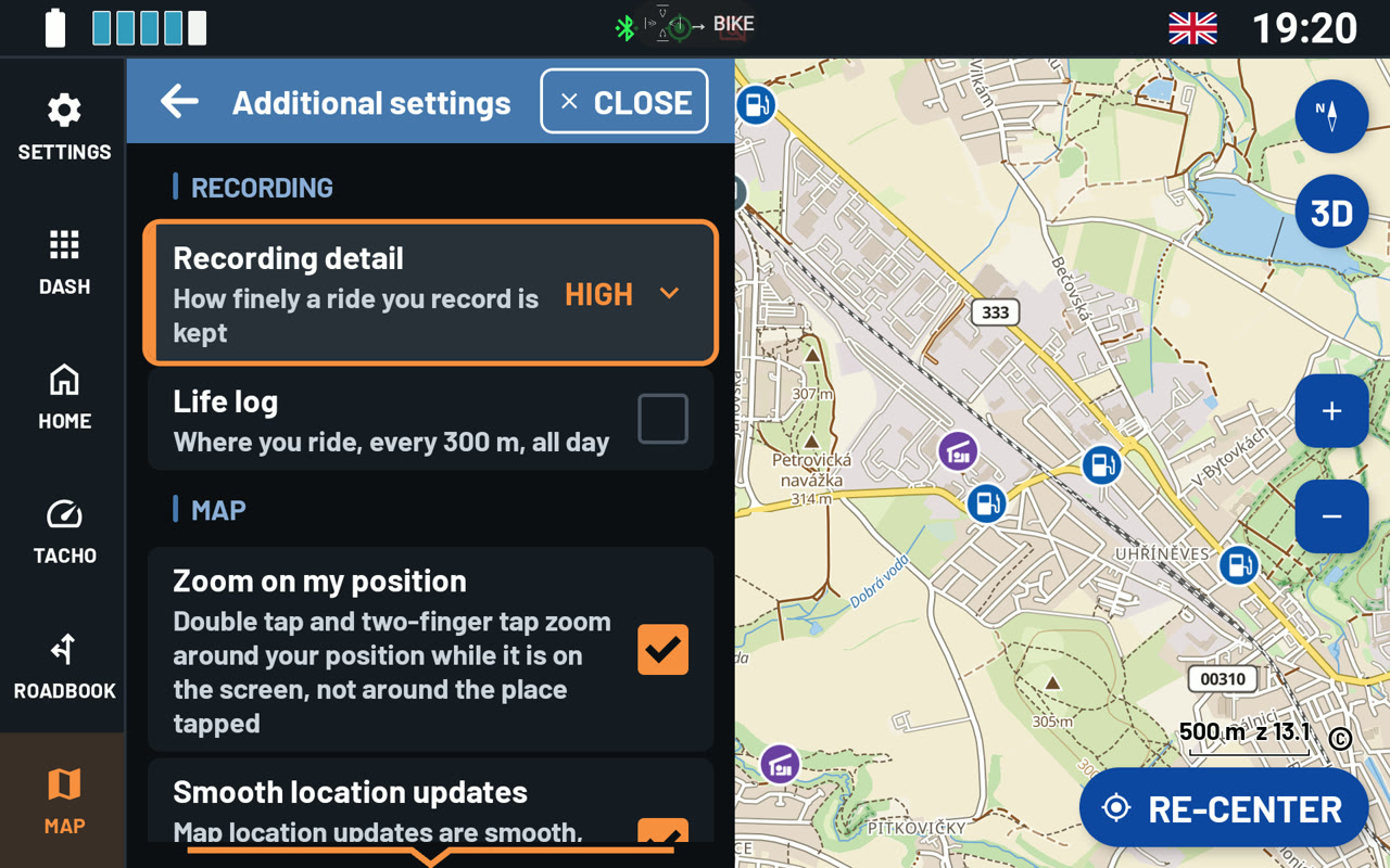
- Recording detail sets how often NGH saves a point. High: every second or every 10 m. Medium: every 5 seconds, every 50 m or at a 45° turn. Low: every 300 m. You find it under Menu › PREFERENCES › Additional settings.
- Life log records where you ride all day, every 300 m. It keeps this in a folder of its own. You do not need to start a recording.
Roadbook training on the map
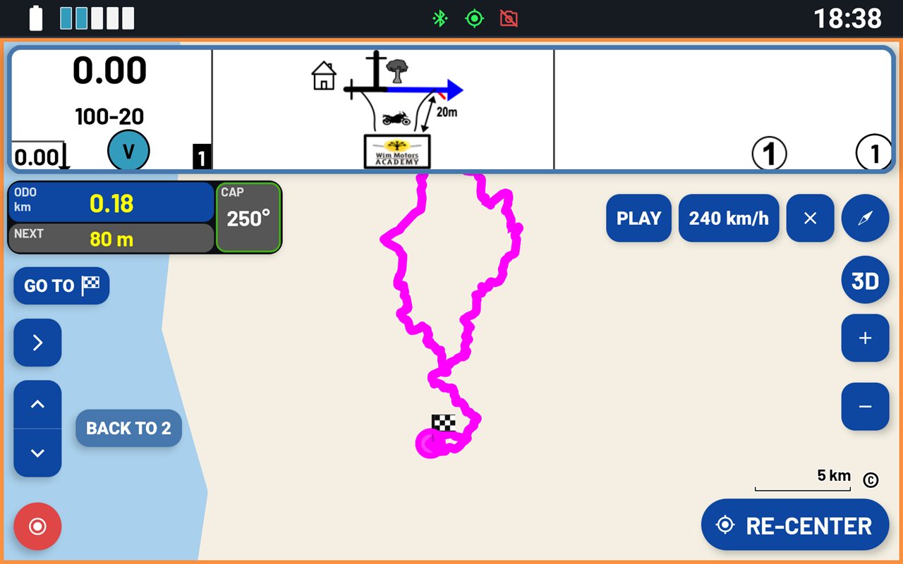
You can practise a rally roadbook before the start. NGH shows one roadbook box over the map, together with the roadbook's whole track.
- Go to Menu › ROADBOOKS › Roadbook training.
- Tap Import a roadbook and pick a digital roadbook in OpenRally GPX format, as Terrapirata uses. It replaces the current roadbook, also in the ROADBOOK section.
- Tap Train on the map: NGH follows your position along the roadbook's track. Or tap Bench ride: NGH plays a ride along the track at the speed you set. You can watch it without riding.
Step through the boxes and correct the ODO, just as you would on the bike. PLAY runs the roadbook at speed, and PAUSE stops it. You can drag ODO and CAP anywhere on the map. Stop training ends the training.
Note: A PDF roadbook has no track to follow on the map. It opens in the ROADBOOK section.
Was this article helpful?
That’s Great!
Thank you for your feedback
Sorry! We couldn't be helpful
Thank you for your feedback
Feedback sent
We appreciate your effort and will try to fix the article